GroundProbe - High-Speed Radar Scanning for Strategic Rail Track Maintenance
|
GroundProbe provides high-speed rail ballast radar scanning using the X-TRACK™ ground penetrating radar (GPR) system, for strategic rail track maintenance. We offer a service to characterise ballast, sub-grade and drainage condition. Our service allows clients to make significant cost savings in their undercutting and track remediation programmes. Our unique capability is to convert geophysical data into continuous maps of the operational parameters required to maintain track. Ballast scanning systemThe high-speed (100km/hr+) X-TRACK ballast scanning system continuously monitors ballast and sub-ballast quality, condition and degradation rates. This information allows track maintenance to be prioritised and focused, thereby drastically reducing maintenance costs, improving track availability and increasing profitability. High-speed ballast scanning systemNear-capacity track usage means that minimal time is available to maintain track. It is therefore vital that maintenance operations are run as efficiently and effectively as possible. The X-TRACK high-speed ballast scanning system rapidly classifies track condition without interrupting normal freight or passenger operations. This ensures that degraded track is prioritised for maintenance and resources are not wasted repairing track that is in good condition. Information for planning track maintenance, schedules and budgetsGPR also enables track maintenance managers to be proactive rather than reactive by providing them with the necessary information for planning maintenance, schedules and budgets. Use of GPR for ongoing monitoring of track condition over time enables qualitative assessments of track degradation rates to be made so that track can be remediated before costly speed restrictions are imposed. Benefits of using GPR for high-speed track condition monitoringThe direct benefits of our X-TRACK ballast scanning system for rail GPR for high-speed track condition monitoring include:
The overriding advantage is the ability to optimise remediation of ballast and drainage for sustained increase in track throughput. When such valuable data is correlated with other engineering datasets, long-term planning is greatly improved. High-speed data classification of ballast conditionThe high-speed data classification that GroundProbe offers delivers relevant ballast condition parameters such as:
Parameter sets are optimised to suit specific maintenance and renewal strategies. This information allows our customers to monitor and target ballast renewal programmes with a much higher lever of efficiency and certainty. Other services we offer include:
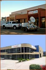
About GroundProbeGroundProbe provides precise, key information for risk management. Renowned internationally for its slope stability radar, GroundProbe's unique measurement systems have expanded to provide sub-surface mapping for global infrastructure and mining applications. Critical information is essential to improve profitability and reduce risk. GroundProbe provides state-of-the-art subsurface mapping solutions that provide efficient and cost-effective ground management. GroundProbe's solutions drastically reduce the need for trenching, excavation and drilling, and enable timely and informed decision making. Our safety record and operational competence make us the preferred supplier of sub-surface information to the major blue-chip companies. With over 170 staff in offices in Australia, Africa, North America and South America, and expansion into Asia and Europe, customers benefit from GroundProbe's global footprint.
GroundProbe
8 Hockings Street PO Box 3934 South Brisbane Queensland 4101 Australia Tel: +61 7 3010 8999 Tel: +61 7 3010 8923 Fax: +61 7 3010 8988 Email: info@groundprobe.com URL: www.groundprobe.com URL: www.groundprobe.com/docs/GF%20Flyer%20Railway.pdf |